
Contour drains and benches – are they an effective long-term run-off and sediment control method?
This is a republished conference paper from AusIMM's 2023 Life of Mine Conference in Brisbane, Australia. AusIMM members can access the full Conference Proceedings via the Digital Library.
Introduction
A common and cost-effective method for post-mining landscapes is to construct linear hillslopes with a break in the hillslope at appropriate distances to reduce hillslope length and resultant erosion risk (Figure 1). The break in slope occurs at a point that has been found by local experience to be appropriate for the materials and climate. As seen in Figure 1, further enhancement of the linear hillslope may be assisted by surface treatment such as ripping (Saynor, Lowry and Boyden, 2019). Firstly, ripping introduces surface roughness which breaks up flow paths, reducing flow velocity thereby reducing erosion potential. The depression produced by the ripping acts as a trap which captures water, sediment and organic matter.
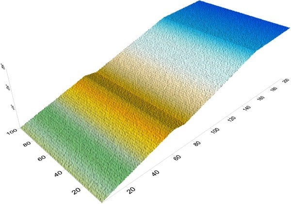
Figure 1. Hillslope with random roughness and ripping added.
Most areas of the world use linear slopes and benches. However, they can also be prone to failure if inappropriate material is used (Figure 2). There is a need to demonstrate that linear hillslopes will be erosionally stable.
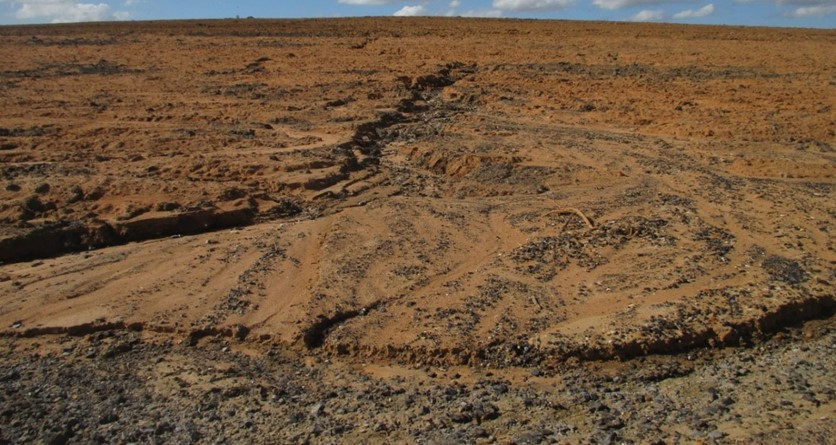
Figure 2. A recently constructed post-mining landform with a large rill and depositional fan at the base of the slope. This occurred immediately post-construction.
While geomorphic design offers many advantages over linear hillslopes, the designs can be complex and costly to design and construct. Also, there are already many landscapes that have been constructed to a linear design and there is the question as to erosional stability of such landforms at both short and long-term time scales. Should already constructed linear landscapes be reshaped to have an improved hillslope form that reduces erosion and may improve environmental outcomes? Reshaping already constructed landforms will be costly.
The work presented here examines the question as to whether a conventionally constructed hillslope can be erosionally and geomorphically stable at decadal and centennial time scales. Here, a post-mining landscape constructed of linear hillslopes and a bench is examined for its evolution at both decadal and centennial time scales. A Landform Evolution Model (LEM), SIBERIA, is used to assess the erosional stability of the landform. A series of different parameters representing a range of climates and surface properties are examined. Different initial surface treatments (ripping and vegetation) are also examined.
Materials and methods
Here a single hillslope is examined which is typical of that used by the mining industry (Figure 1). The hillslope is 200 m long and 100 m wide. The hillslope profile consists of a cap with a slope length of 30 m with a slope of 1 per cent which then increases to 20 per cent for a distance of 80 m. This slope is broken by a bench with a backslope into the hillslope with a slope of 5 per cent.
Two different surface treatments examined are (i) random surface roughness; and (ii) a rip depth of 0.3 m spaced at 1.2 m intervals.
SIBERIA (Willgoose, 2018) is an LEM that has been used extensively for erosion assessment on post-mining landscapes. SIBERIA provides a three-dimensional visualisation of erosion and deposition and where it occurs (ie gullies, rills) and rates of erosion and deposition both at the individual grid scale as well as whole landscape (ie t ha-1 yr-1).
Before use, parameters for the sediment transport equation and area-discharge relationship are needed. Here a set of existing parameters from a coalmine in the Bowen Basin are used that are considered generally representative. One set of parameters is considered to be ‘moderate erodibility’ material’ and a second set of parameters was considered to be ‘low erodibility’ material. Both materials are run with and without vegetation.
The SIBERIA model was run for 100 years as this was considered sufficiently long as to provide inference as to longer term landscape trajectory. The 100-year time period is also within a human management time frame.
Results and discussion
Moderate erodibility material
At ten years there are small gullies both on the top and bottom lifts with no ripping (Figure 3). There is deposition evident at the base of the top lift on the bench. There is no depositional material at the base of the hillslope as all eroded material is allowed to exit. The gullies are 1.21 m deep and 0.8 to 1 m wide. On the bottom lift there is considerable deposition and reworking of this material.
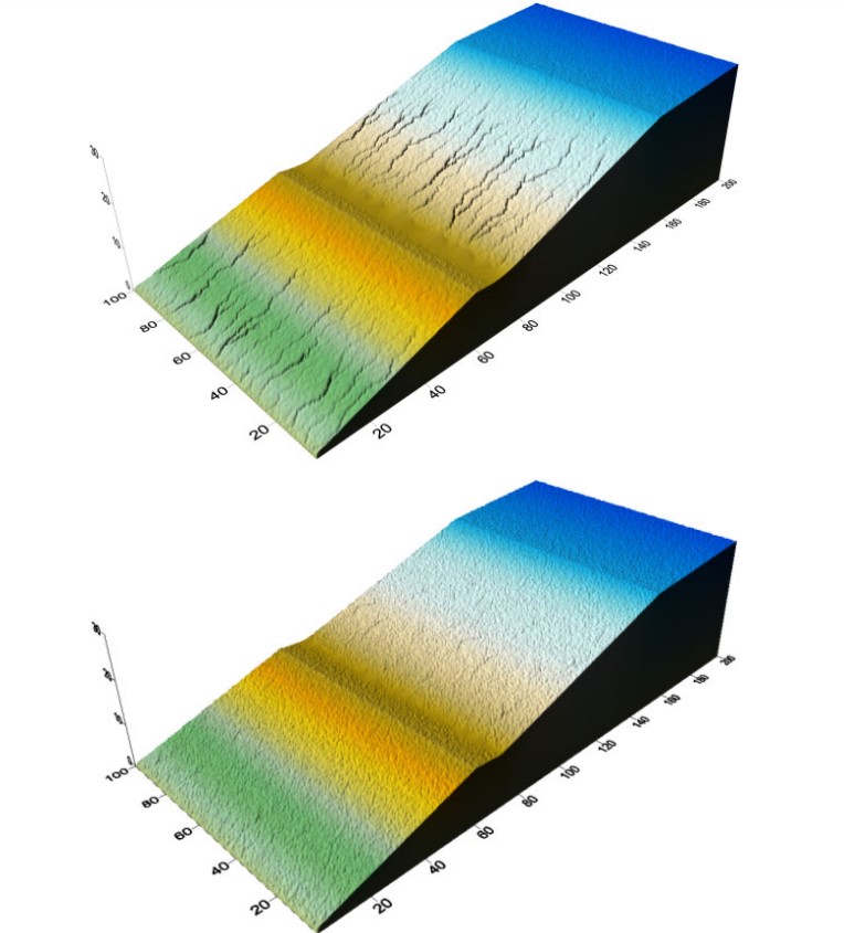
Figure 3. Post-mine slope at ten years bottom using moderate erosion parameters and ripping without vegetation (top) and with vegetation (bottom).
With vegetation, at ten years there is minimal rilling, demonstrating the effectiveness of vegetation in managing erosion. Deposition is evident along the bench. However, post-ten years rills and gullies deepen. At 100 years the entire hillslope has gullies with the entire hillslope incised including the cap. Erosion increases once gullying begins (Figure 4). Maximum erosion depth is 0.355 m at ten years and increases to 4.63 m at 100 years.
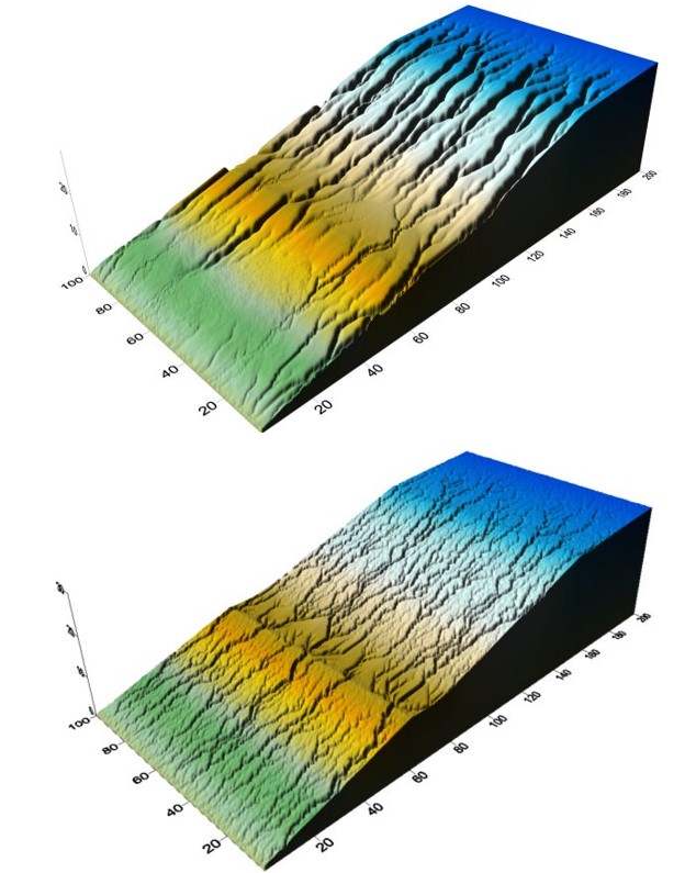
Figure 4. Post-mine slope at 100 years bottom using moderate erosion parameters and ripping without vegetation (top) and with vegetation (bottom).
The results demonstrate that while vegetation may reduce erosion in the short-term (ie ten years), long-term the erodibility of the materials will override the influence of vegetation.
Low erodibility material
Low erodibility material erosion occurs by sheetwash (Figure 5). Gullies are relatively shallow and wide. Erosion of the bench has occurred with deposition present but it is still present and effective.
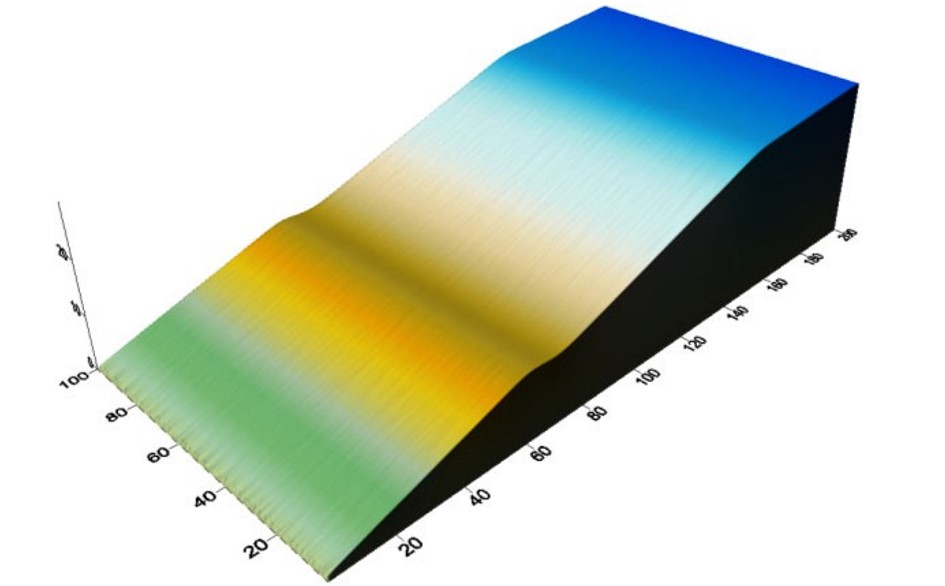
Figure 5. Post-mine slope at 100 years bottom using moderate erosion parameters and ripping with vegetation.
In all cases ripping along the contour reduces erosion over the first ten years. Ripping also prevents gully development. However, the effect of the rips did not last with the erosion rate increasing to that similar to the unripped surface.
Conclusions
The results demonstrate that a conventionally constructed hillslope can be erosionally stable at centennial time scales. However, this can only be achieved for materials with low erodibility. A landscape should be designed based on the material properties – not make the materials fit the landscape. Over the short-term, forcing the material to fit the landscape may work but over the long- term the materials will override the imposed landscape form. For more erodible materials, vegetation may reduce erosion in the short-term however erosion rates will trend upwards from an initial lower erosion rate.
The major outcome of this work is that material properties matter. A landscape constructed of low erodibility material can be erosionally stable at centennial time scales. That is, conventional landscapes can be erosionally stable with the right material and vegetation. Vegetation may reduce erosion for higher erodibility materials; however, vegetation may fail, be reduced by drought and fire or poorly managed (ie introduction of grazing animals). Vegetation alone is not a long-term solution for erosional stability
Ripping offers the potential to reduce erosion over the short-term. However, the effectiveness of ripping reduces over time and the material properties come to dominate over rather than the surface form. Ripping is a short-term solution to mitigate erosion for materials with low erosional stability but it is not a long-term solution. Ripping will not reduce erosion for high erodibility materials over the long-term. Ripping may lead to a false confidence in the early years post construction with failure occurring in 5–10 years.
Acknowledgements
This work was supported by the mining industry through Australian Coal Association Research Program (ACARP) Projects C34025: New Landscape Evolution Model for Assessing Rehabilitation and C27042: Adaption of design tools to better design rehabilitation and capping over highly mobile mine waste and Australian Research Council Discovery Grant DP110101216.
References
Saynor, M J, Lowry, J B C and Boyden, J M, 2019. Assessment of rip lines using CAESAR-Lisflood on a trial landform at the Ranger Uranium Mine, Land Degrad Dev, 30:504–514. https://doi.org/10.1002/ldr.3242
Willgoose, G R, 2018. Principles of Soilscape and Landscape Evolution (Cambridge University Press: Cambridge).