
How cooperation leads to greater efficiency and faster decarbonisation
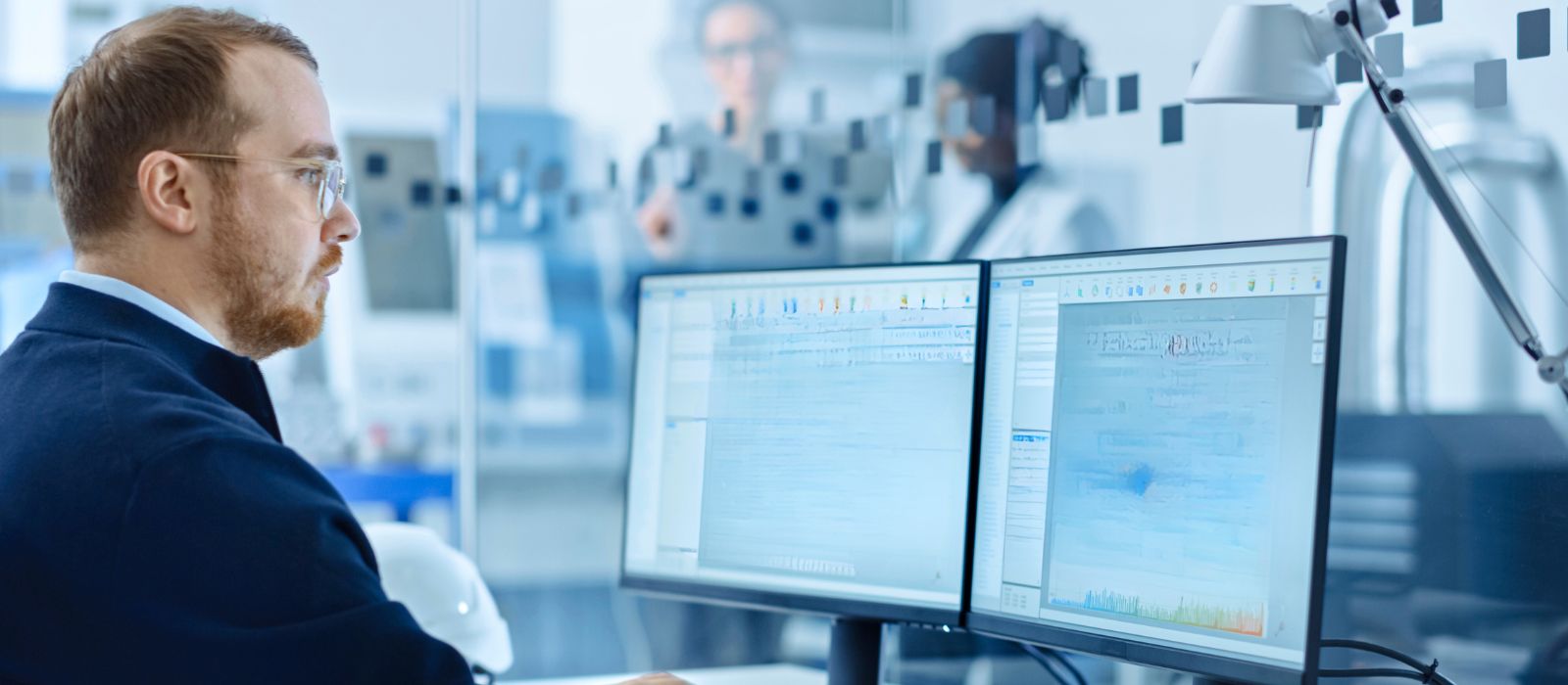
The ever-increasing demand for critical minerals required to support global decarbonisation is placing great responsibility on mining companies to produce those minerals as quickly as possible. It’s a big ask. To achieve it, the mining industry will require a revolutionary level of technological cooperation from one end of the supply chain to the other, and beyond.
A world-wide switch to electric vehicles is generally acknowledged as a fundamental component of decarbonisation. However, while demand for energy-dense batteries continues to soar, limited availability of the raw materials they require, such as lithium, nickel, and cobalt, is creating a major supply chain bottleneck — a bottleneck that threatens to impede their widespread adoption.
The International Energy Agency estimates that at least 50 new lithium projects, as many as 60 new nickel mines, and up to 17 cobalt new mines must be developed by 2030 to meet demand. While these numbers may change – if solid-state battery technology matures quickly, for example, it will reduce the need for some metals – the reality is that the mining industry typically takes roughly 15 years to develop a new project from discovery to production. And that slowness may be contributing to some EV manufacturers bypassing traditional supply chains and engaging directly with mines to secure the primary materials they need through offtake agreements. These offtake agreements, in turn, indicate:
- that the price of mining production is no longer solely governed by the commodities market
- that mining operations must now be regarded as an integral part of complex and interconnected supply chains, and
- that miners must be able to plug into the even more complex and technologically advanced supply chains of established EV and battery makers or they will lose market share.
The same pressure to develop projects as quickly as possible holds true for mines producing other materials as well, but environmental permits and all the other elements required for sustainable mining take the time they have to take, regardless of what is being mined.
Where we think it is possible for mines to move more quickly is within their own organisations by adopting technology that makes them internally more efficient while also helping them transfigure their supply chains, both to incorporate mining operations and to link to their customers’ currently more advanced supply networks.
The key is cooperation
We believe mining companies need to work more cooperatively than they are now, because cooperation leads to efficiency, efficiency leads to greater speed, and greater speed leads to faster decarbonisation, not only in e-product manufacturing but also in mining companies’ efforts to reduce their own carbon footprints.
Mining is a series of interlinked processes that begins with the process of securing permits, moves through the processes of exploration, development, and production, and ends with the processes of decommissioning and site rehabilitation. Each process requires its own system – its own working methods and principles and objectives – but all systems are ultimately working to reach the same overall goal and all depend on access to relevant and reliable data to make sound, well-informed decisions. Yet many mining companies today maintain their systems as distinct entities, each with its own data sources, data management procedures, and methods of communicating information.
Geology modeling, for example, is often viewed as separate from other mine systems, such as mine operations, beneficiation, logistics, marketing, and sales. However, the geology of a site is integral to every other systems because it influences not only drill and blast planning, but also excavation, loading, hauling, feeding, processing, and, of course, the end result: how much a mine produces and for how long.
Ensuring that the latest geoscience data can be easily shared among both geology team members and all other interconnected mine systems opens the door to the kind of end-to-end cooperation that reduces roadblocks and delays along the supply chain and provides a more reliable foundation for chain-wide decision making.
To illustrate how to create and support cooperation in and across mining systems, we use the GEOVIA Geology Modeler, which is based on Dassault Systèmes 3DEXPERIENCE platform, as an example. For simplicity's sake in this article we will refer to this as 'the Geology Modeler'.
The Geology Modeler
The Geology Modeler includes two applications essential to reliable geological data analysis: Geoscience Referential Manager and Geology Modeling, which uses implicit modeling.
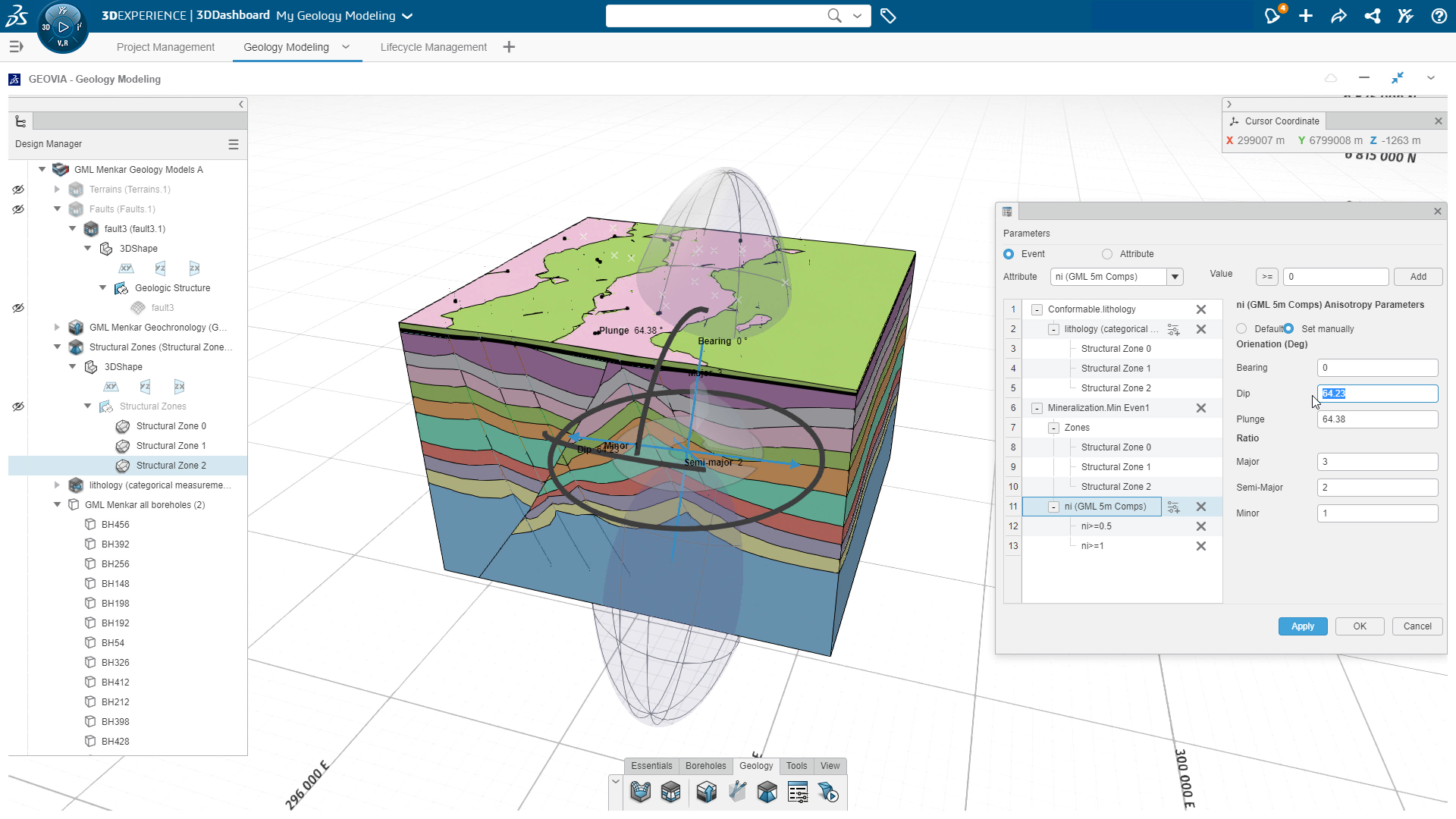
Implicit modeling employs mathematical algorithms to make use of all available geological data in interpreting the formation of surfaces, such as grade and faults, between known drill hole points. It can then rapidly build multiple 3D subsurface scenarios from that data, enabling geologists to examine more geologic possibilities then they could with explicit modeling workflows. But just as with explicit modeling, the reliability of those scenarios is entirely a function of the quality of the data entered into the model.
High-quality data requires:
• secure, effective data management
• comprehensive geological visualisation and analysis
• correct data interpretation, and
• precise model validation.
And the best way to ensure all of that is by using a single, platform-based, centralised repository in the cloud where all your mine’s geoscience data, in any format, can be integrated, stored, analysed, interpreted, and managed. This ensures geologists do not have to go from one application or file type to another to find relevant data, making it easier for them to identify critical trends and patterns and produce the most accurate geological models. A single repository also guarantees that the latest, most complete version of any data becomes the single source of truth for everyone (with the right permissions) to reference, even as multiple users work on the same data at the same time.
The Geology Referential Manager defines and manages all the geoscience reference data, structured and unstructured, that is collected by geoscientists, engineers, consultants, and contractors. This includes geological field observations, topographical point cloud, geochemical, lithological and remote sensing data, drill hole records, assays, etc. Immediately as new information is acquired, the Geology Referential Manager automatically updates the data across the platform, and anyone with access can see and use that updated data (the old data is not deleted, however; best practice is to allow complete traceability and auditability).
From that foundation of reliable data, geologists can then use the Geology Modeler to automate the creation of implicit geology models, without time-consuming wireframing. At the same time, because the Geology Modeler provides multiple functions, like meshing control lines and a broad range of parameter settings (such as dynamic anisotropy), geologists retain the control they need to represent the full array of in-ground conditions and geological structures that are essential for building a complete model (a virtual twin) of the geological asset. And because it also employs parametric design principles, those same geologists do not need to start again from scratch whenever new data comes in, reducing time and effort even more.
Creating team cooperation
In addition to saving time, here’s how using new technology such as the Geology Modeler also works to build new levels of cooperation.
Let’s say that your mining company is at the end of the exploration phase for a new mineral project. After you’ve compiled your exploration borehole database, received your assay results, etc., and stored all structured and unstructured resource definition data (including any existing explicit models generated by any software) on the integrated digital platform, where it has been defined by the Geology Referential Manager.
- Your project manager:
- develops a project plan
- creates a shared space on the platform for all team members involved in the project, where they all have access as required to the same set of applications, tools, and workflows
- assigns each team member specific tasks and provides a timeframe for completing those tasks, and
- monitors project progress — including any bottlenecks — against the project plan using a number of different visual methods.
- Each team member:
- receives an email indicating that they have been assigned a task
- logs in to the platform, where they can drag and drop any data held on the platform or stored locally to begin work immediately, which
- triggers automatic document versioning, data check-in/check-out, and user file and folder permissions to ensure traceability and auditability.
After the team has interpreted all structured and unstructured geoscience data, the assigned modeling geologist uses the Geology Modeler to create a geological model with traceable versioning over time. With the modeling done, the geologist updates the task as complete, which sends a message to the project manager. The manager can then review the model and the modeling process, request changes or approve the results, and share the model with the rest of the project team inside their collaborative space on the platform.
The team then moves on to validation, which may involve:
- creating sectional views and conducting a visual analysis of the domains compared to the actual data
- using query filters to test the model, and/or
- sharing the model across the mine for collaborative peer review.
When the time comes to update the model with new information – new drillhole data, for example – the geologist authorised to make changes will:
- review and validate the updated data
- create an interpretation – for example, by producing a composite to use, either for a numerical interpretation or to adjust lithologies for a geological interpretation (or both at the same time)
- make a copy of the old model to be updated (or simply create a new model)
- define the geochronology, creates structural zones, and sets the parameters for how zones will relate to each other
- generate an up-to-date geology model in a simple, repeatable process
- return to the collaborative space, and
- update the task as completed – all in a matter of minutes.
Creating external cooperation
As soon as that new, up-to-date geological model is generated, it will be of interest to many of your mine systems and downstream processes.
For example, mine planners and mine engineers need to know about anything that may directly or indirectly affect how they schedule blocks for mining. Through the Geology Modeler, they can be included on any updates to the model that trigger material change and reclassification. Processing engineers or metallurgists also often need detailed information on expected ROM and feed — for example, to help investigate why and how deleterious elements or minerals will affect downstream processing.
This kind of operation and supply-chain-wide cooperation enables mines to better address issues and delays when they occur, reducing their impact on the business, and to take critical business decisions faster, making them more agile and efficient. Efficient enough, we think, to help reduce the time it takes from exploration to production, which can in turn help to spur decarbonisation at the mine and all the way along the supply chain.
Cooperation, however, is not limited to inside your own mining company or supply chain. You can also configure digital platforms to include external stakeholder communication and collaboration during the permitting process. And you can share all your models — geological models, resource models, tailing models, etc. — in varying levels of detail as required, from the high level of detail required by regulators to ensure compliance, to the lower levels of detail required by shareholders, investors, or local communities, leading to smoother communications, greater transparency and trust, and, again, more efficiency.
Another important bonus: a cloud-based platform also means that you will be able to immediately plug into the supply chains of established EV and battery makers or other potential partners as required, helping to stimulate decarbonisation world-wide.
Find out more: If you’re interested to learn more, we invite readers to join the GEOVIA User Community by Dassault Systèmes, to read about industry topics from experts. All industry professionals are welcome to learn, engage, discover, and share knowledge to shape a sustainable future of mining.